About this table
about clipping collars and new rectangles
about tfw files
documentation from the USGS CDROM
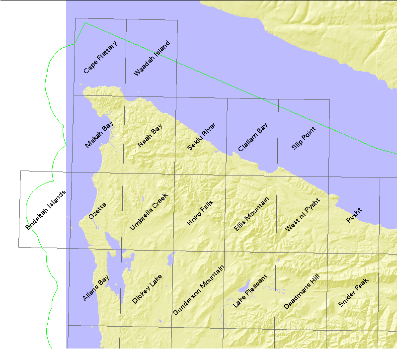
| USGS name | # quads | DNR# | name | file size |
|---|---|---|---|---|
| c48124a1 | 20 | - | (1°×2° quad) | 4355072 |
| See unclipped maps | - | - | CAPE FLATTERY (SE quarter) | |
| z48124 | 20 | - | (Mosaicked 24K quads) | 70250104 |
| o48124d6 | 1 | 503 | Cape Flattery | 3364885 |
| o48124d5 | 1 | 504 | Waadah Island | 2783271 |
| o48124c6 | 1 | 603 | Makah Bay | 3301675 |
| o48124c5 | 1 | 604 | Neah Bay | 4178577 |
| o48124c4 | 1 | 605 | Sekiu River | 3223746 |
| o48124c3 | 1 | 606 | Clallam Bay | 3375923 |
| o48124c2 | 1 | 607 | Slip Point | 2757753 |
| o48124b7 | 1 | 702 | Bodelteh Islands | 3024023 |
| o48124b6 | 1 | 703 | Ozette | 4176057 |
| o48124b5 | 1 | 704 | Umbrella Creek | 3741380 |
| o48124b4 | 1 | 705 | Hoko Falls | 4085439 |
| o48124b3 | 1 | 706 | Ellis Mountain | 3780655 |
| o48124b2 | 1 | 707 | West of Pysht | 3262346 |
| o48124b1 | 1 | 708 | Pysht | 3320818 |
| o48124a6 | 1 | 803 | Allens Bay | 2849521 |
| o48124a5 | 1 | 804 | Dickey Lake | 3657148 |
| o48124a4 | 1 | 805 | Gunderson Mountain | 3814369 |
| o48124a3 | 1 | 806 | Lake Pleasant | 3781489 |
| o48124a2 | 1 | 807 | Deadmans Hill | 3340102 |
| o48124a1 | 1 | 808 | Snider Peak | 4344432 |