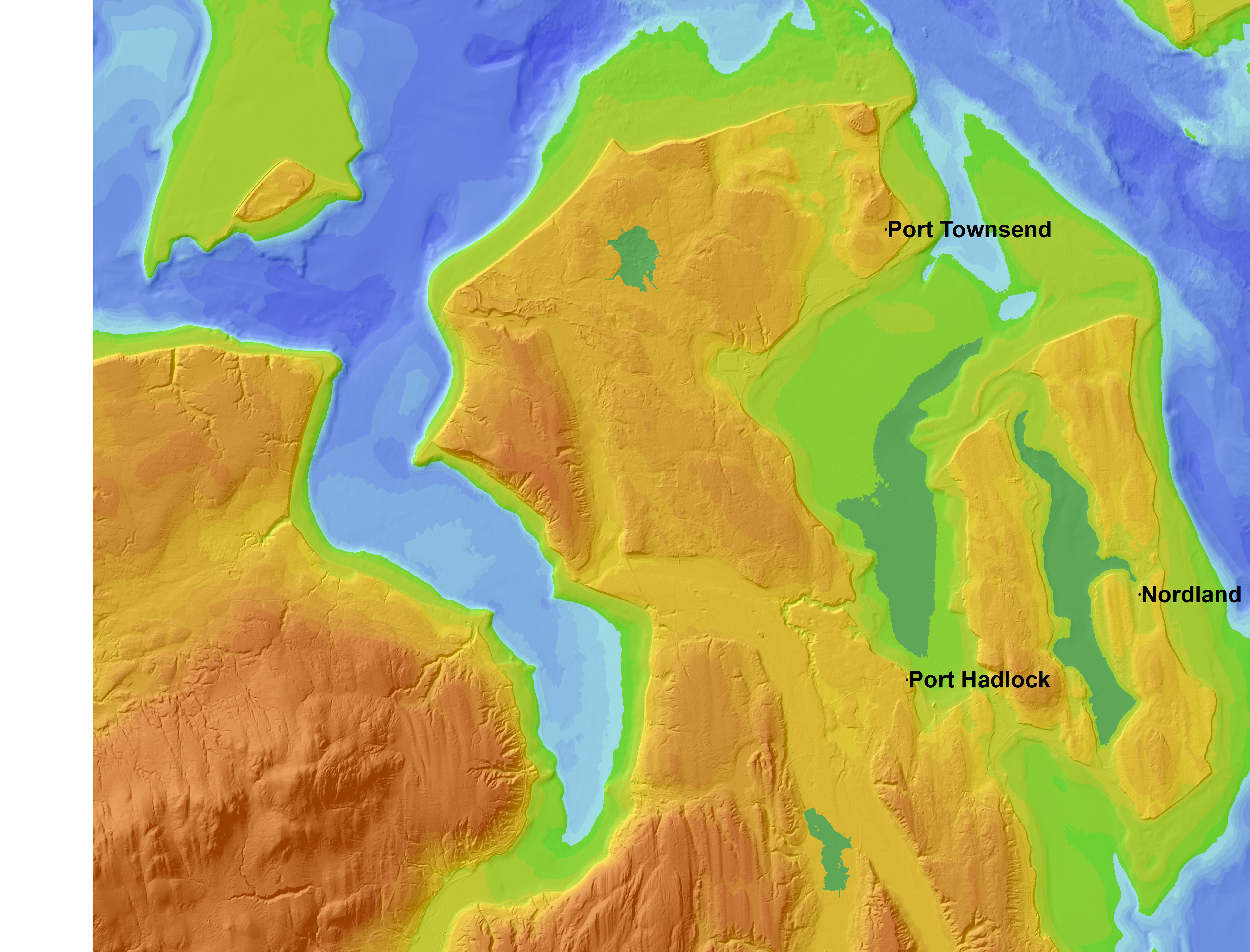
 4000 years B.P.
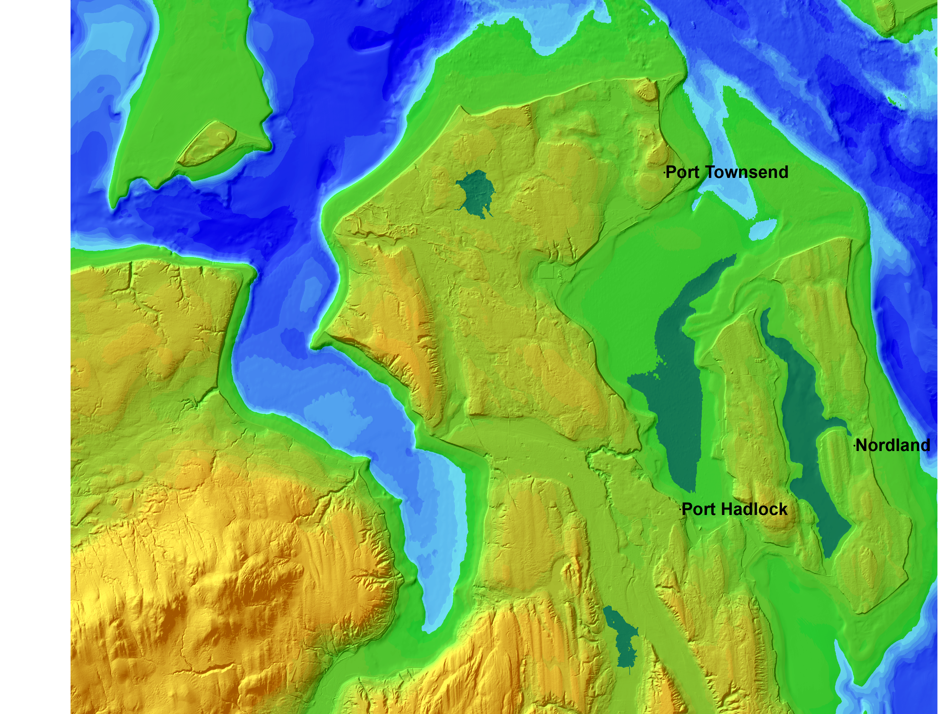
 b. 4000 years B.P.
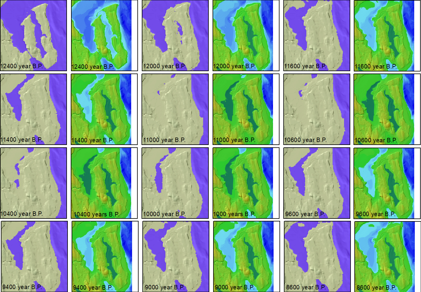
Wait, We should first be sure that we understand exactly how Ralph's model works.
Our model is driven what we know about glacier advance, sea level change, and isostatic rebound (the bouncing back of the land when the weight of ice ws removed). It does not take into account glacier scouring or deposition—even though glacier outwash is shown— nor human alterations to the landscape. Nor does it attempt to show the extent of alpine glaciers (which had very little corellation to continental glacial advance. It is based on extensive geological field work, and results for any specific area ought to be checked by extensive geological field work,
Work with topographic and bathymetric data can be complicated because bathymetry is based on mean low water. The variation from the terrestrial vertical datum is complicated, and has not traditionally been calculated for a raster-based conception of the earth. Our 2011 movie was based on David Finlayson's integrated Puget Sound model, but we found an new NOAA data set at https://coast.noaa.gov/dataviewer/#/lidar/search/where:ID=9112/details/9112 The cell size is one meter, and our full movie extent would involve downloading a few hundred gigabytes of data. We had to resample to 5-meter pixels even for our zoomed-in images. (Note that there are some dataset-merge artifacts, such as a 5-meter north-south gash across a lake at 5318740N 514969E.) The next best resolution integrated data set is ETOPO15. This is something to mull over. And we want to know if Ralph is happy with the 2011 models of sea level rise, rebound, and ice thickness.
We arew giving Passage Through the same attention that we have given in Lake Washingon, showing how it would have existed as a lake, and not have emptied out as the old movie implied. In fact, we have run the "fill" function to find every lake, then filtered out the samll ones.
The 2011 movie ran 175 seconds, built from 401 map images. We do not know if the
full frame movie comprises 401 images. Our eventual products will include an updated
Puget Sound movie, a zoomed-in movie, and whatever static images the State Park and the tribe
can use. This page can be modified to show more static images, and to serve as metadata.
October 31: Here are eight timesteps as high-res lossless png files. The shaded relief was de-emphsized because it shows what may be wave-cut platforms from our recent near-constant sea level. I can go ahead and create a movie of the last 15,800 years (I need to do a little work to tranlate the ice model to the new software.) but I would appreciate some feedback first.
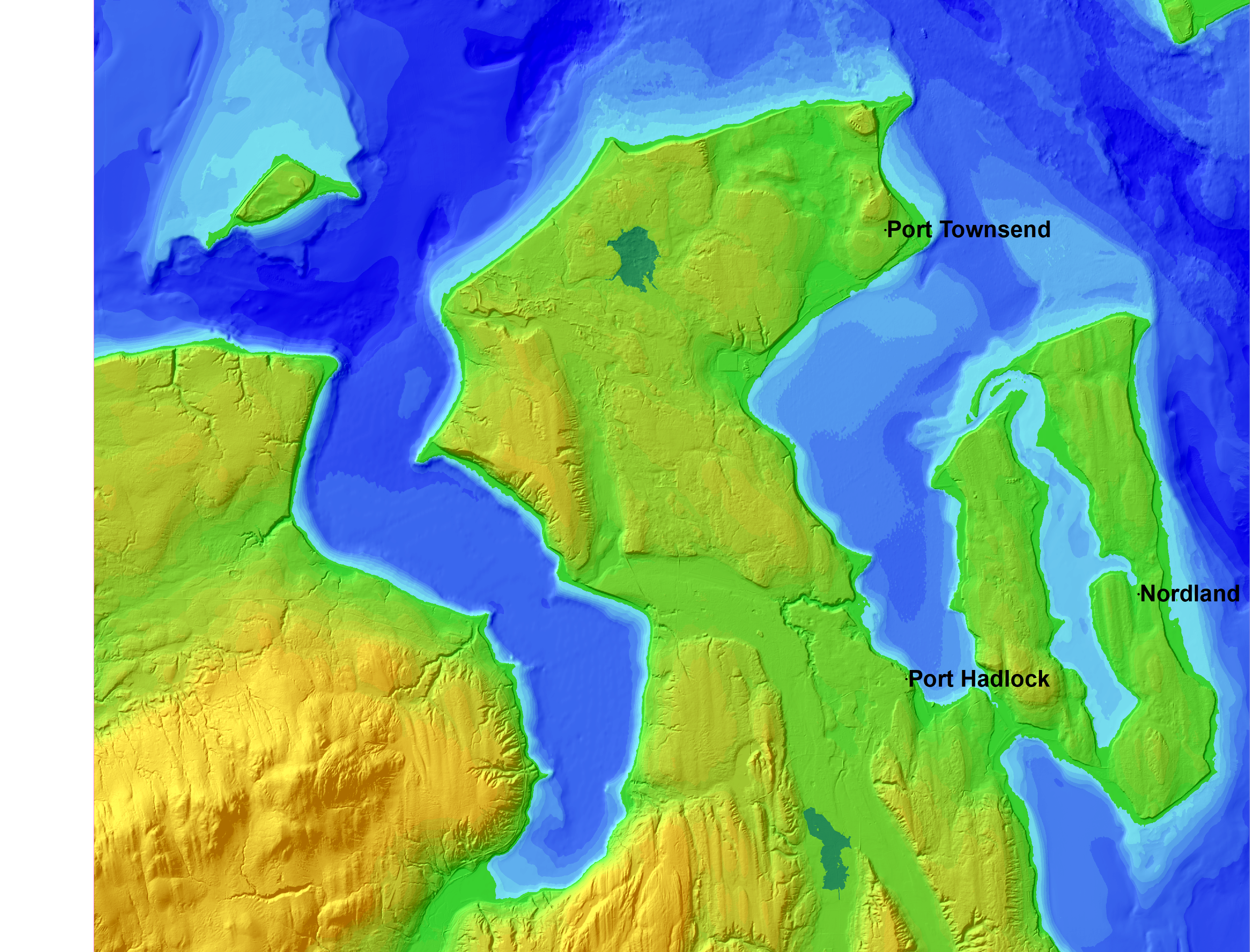
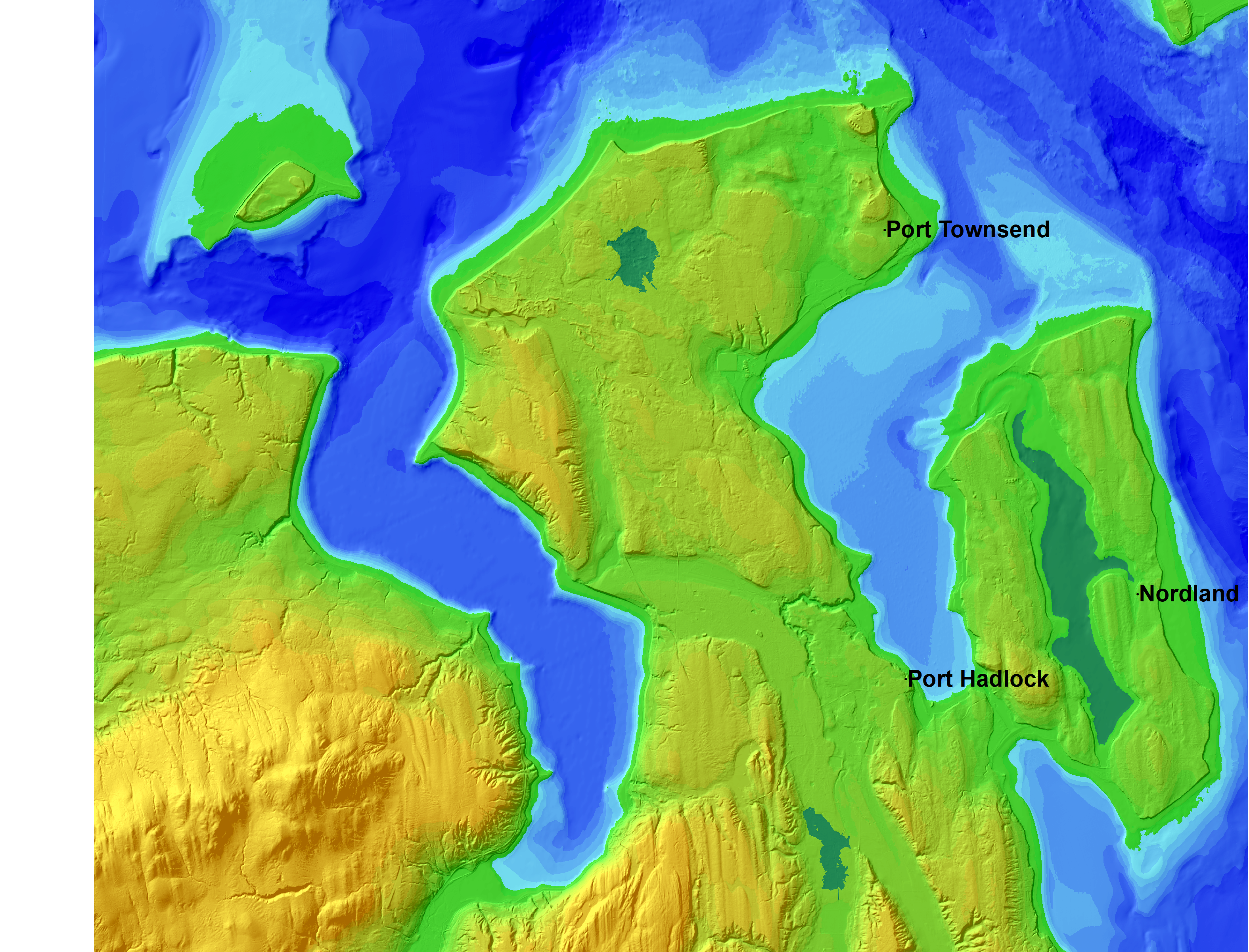
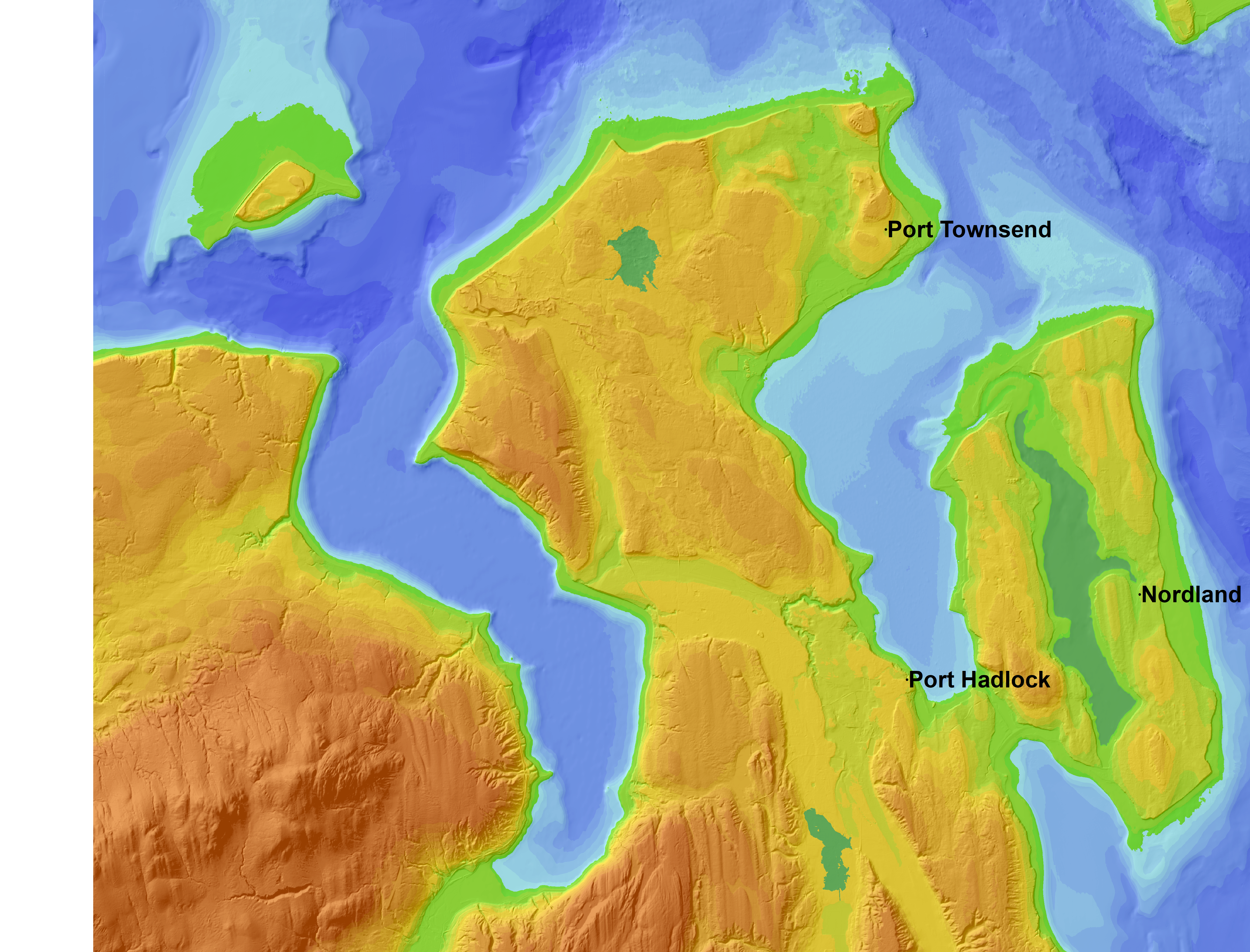
Here are the November 27 canditate images for the S'Klallam booklet:
4000 years B.P.
b. 4000 years B.P.
 7500 years B.P.
 b. 7500 years B.P.
 11000 years B.P.
 b. 11000 years B.P.
We have made one change to our base DEM before rerunning our model, adding the Chimakum Portage that connected Indian Island to the Olympic Mainland until 1915.